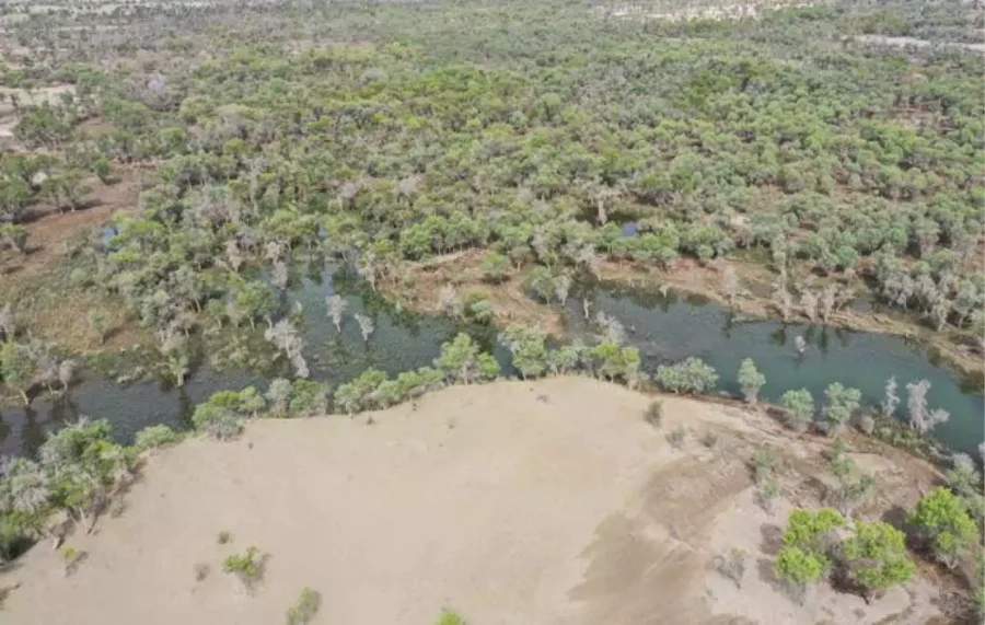
By focusing on key desert fringe areas and taking innovative, scientific and comprehensive measures for wind prevention, sand and desertification control, as well as dust suppression, China has made a promising start to its campaign to tame desert areas and created a model of sand control and desertification prevention and control.
Last year, China initiated a battle against sand in Minqincounty, Wuwei city, northwest China’s Gansu Province, aiming to tame the desert areas stretching from the Hexi Corridor in Gansu all the way to the fringe areas of the country’s largest desert, the Taklimakan Desert.
Spanning four provincial-level regions, including north China’s Inner Mongolia Autonomous Region, Gansu Province, northwest China’s Qinghai Province and Xinjiang Uygur Autonomous Region, and the Xinjiang Production and Construction Corps, the Hexi Corridor-Taklimakan Desert edge region is a critical source and pathway for sandstorms in China.
So far, Inner Mongolia, Gansu, Qinghai, Xinjiang, and the Xinjiang Production and Construction Corps have completed comprehensive treatment on 3.18 million, 2.12 million, 2.76 million, 5.91 million, and 1.42 million mu (1 mu equals about 667 square meters) of land respectively, getting the battle off to a good start.
Afforestation projects hold the key to China’s notable achievements in sand control and desertification prevention and control.
As a provincial-level region with the largest desertified and sandy area, Xinjiang has seen increased vegetation around the Taklimakan Desert, thanks to the country’s large-scale afforestation project, the Three-North Shelterbelt Forest Program (TSFP).
In recent years, the region has significantly reduced the area of desertified and sandy lands under the TSFP, realizing a historic transformation from a situation of “sand forcing humans to retreat” to “trees forcing sand to retreat”.
Today, slogans on sand control and desertification prevention can be seen everywhere in the fringe areas of the Taklimakan Desert, where lush vegetation forms a “green neckerchief” around the desert.
Qiemocounty in Xinjiang, a key area of the battle which is surrounded by sand on three sides, has continuously planted desert trees, such as saxaul, desert poplar, Chinese tamarisk, and Calligonummongolicum, along the desert edge, forming an ecological corridor spanning 129,000 mu.
The county mobilizes local officials and residents for a mass tree-planting campaign each spring, logging over 1.5 million participants to date.
“Everyone pitches in to make the green belt stretch farther into the desert,” said PatigulYasin, a female forest ranger in the county.
This year, Qiemocounty will plant over 20,000 mu of trees in an eco-sand control base to reinforce this ecological corridor, according to PatigulYasin.
On May 20, China kicked off a campaign in Minfengcounty, Hotan prefecture of Xinjiang to further expand the sand fixation and afforestation efforts in the Taklimakan Desert edge, signaling a drive to plug the final 285-km “gap” in the ecological corridor encircling the country’s largest desert.
“Through sustained afforestation efforts, a 2,761-km green shelterbelt has taken shape around the Taklimakan Desert. Once the remaining 285 km is filled, it will form a massive ecological barrier, effectively blocking sand,” said Wang Gang, deputy director of the desertification prevention and control division of Xinjiang’s forestry and grassland bureau.
In an effort to quickly fill the “gap”, the local authorities plan to employ methods such as engineering sand fixation, biological sand control, and photovoltaic sand control, according to Wu Yanlong, deputy chief of the Xinjiang command center of a company responsible for the Hotan section of the campaign.
Aiming to realize the goal of “wind prevention, sand obstruction, and dust control”, the country has targeted the source and pathway regions of wind, sand, and dust, and implemented 14 major projects at key wind erosion outlets, sand invasion areas, and oasis defense gaps, according to an official with the country’s National Forestry and Grassland Administration (NFGA).
These projects have enabled the country to construct a comprehensive framework combining relevant points, lines, and areas, with multiple intertwining corridors and barriers, creating a model of desertification prevention and control.
Led by national comprehensive sand control demonstration areas, relevant authorities and governments have taken scientific measures for comprehensive treatment of desertified lands, key wind erosion outlets, and cross-border sand source areas, ensuring that sand sources do not expand or disperse, and writing a new chapter in China’s miraculous sand control efforts, said an official from a department of the NFGA.


